
Utility Locating & Mapping in St. Cloud & Central Florida
Down To Earth Underground LLC provides utility locating and mapping services to help identify and document existing underground infrastructure before drilling, trenching, excavation and related work.
Better Underground Work Starts With Better Information
Existing buried infrastructure can affect how an underground utility project is planned and completed. Utility locating and mapping help provide more information about what is already below the surface before intrusive work begins.
Down To Earth Underground supports underground utility projects throughout Central Florida with locating and mapping services that can help identify buried routes and provide useful information for drilling, trenching, potholing and excavation planning.
Depending on the project, locating may also be used alongside Ground Penetrating Radar or potholing when additional subsurface verification is needed.
Discuss Your Project
Underground Infrastructure Can Change the Entire Project Approach
The location of existing buried infrastructure can influence the proposed route, excavation method, drilling plan and access strategy.
Route Planning
Locating existing infrastructure can help provide information needed when planning a proposed underground route.
Drilling Preparation
Underground information can help support planning before directional drilling or trenchless boring begins.
Excavation Planning
Utility information can help inform where and how excavation or trenching should proceed.
Potholing Coordination
Locating can help identify areas where targeted potholing may be useful for physical verification.
Site Documentation
Mapping helps organize information about identified underground routes and project conditions.
Method Selection
Better subsurface information can help determine whether drilling, boring, trenching or excavation is the better fit.
Locating Is One Part of Understanding the Underground Conditions
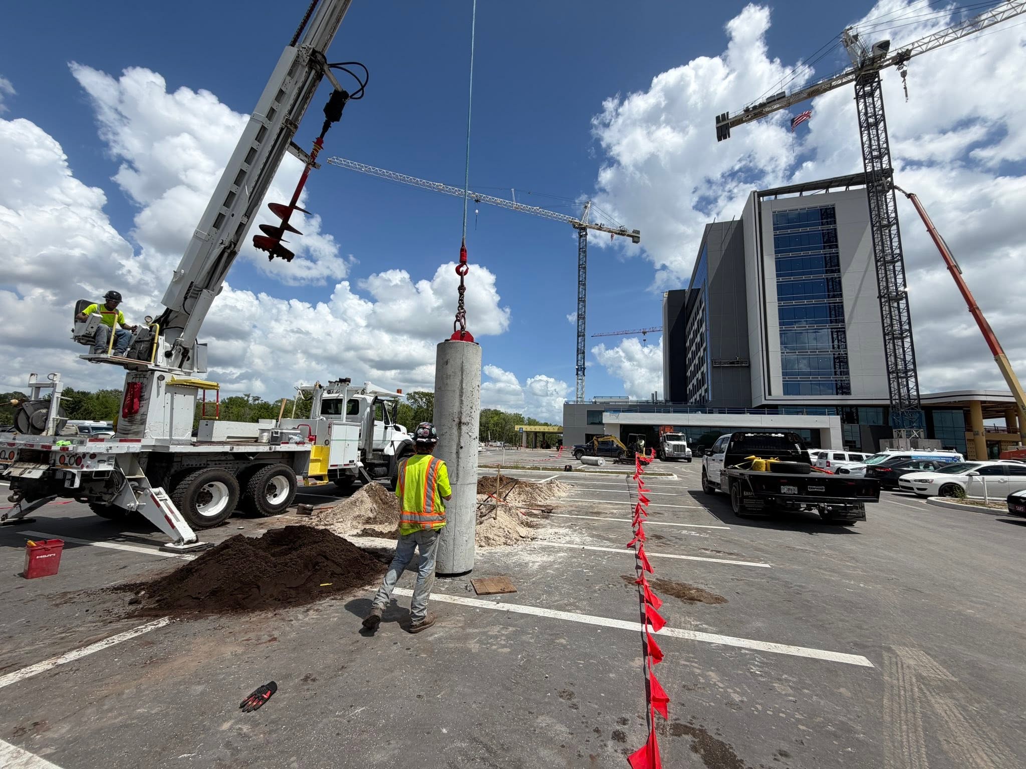
Some projects can be planned using available records and locating information. Others may require additional verification before intrusive work begins.
- Review the proposed project area
- Identify known underground infrastructure
- Locate and document buried utility routes where possible
- Use Ground Penetrating Radar when additional subsurface information is needed
- Use potholing when physical exposure and depth verification are required
- Coordinate the findings with the proposed drilling, trenching or excavation work
Locating, GPR and Potholing Serve Different Purposes
These services can complement one another when a project requires more detailed information about what is below the surface.
Utility Locating & Mapping
Used to help identify and document existing buried utility routes that may affect the project.
Ground Penetrating Radar
GPR can provide additional subsurface information about buried features and underground conditions.
View Ground Penetrating RadarPotholing
Targeted excavation can physically expose buried infrastructure so its position and depth can be verified.
View PotholingLocating Support for a Range of Utility Projects
Underground locating and mapping can be useful before work involving several types of utility infrastructure.
Power
Underground locating support for projects involving power-related infrastructure.
Water
Locating and mapping support for underground water utility routes.
Gas
Underground infrastructure investigation supporting gas-related utility projects.
Communications
Locating support for underground communications infrastructure and related routes.
Fiber Optics
Underground mapping support for fiber optic routes and project planning.
Sewer
Locating and subsurface investigation supporting sewer infrastructure work.
From Underground Information to Underground Work
Once the site and buried infrastructure are better understood, the project may move into drilling, trenchless installation, excavation or utility work.
Horizontal Directional Drilling
Trenchless underground installation for routes where reducing continuous open excavation is important.
Learn MoreUnderground Utility Installation
Underground installation and repair services using methods selected according to the project conditions.
Learn MoreExcavation Services
Open excavation for utility projects where direct access to the underground route is required.
Learn MoreUtility Locating & Mapping Across Our Central Florida Service Area
Down To Earth Underground LLC is based in St. Cloud and provides utility locating, mapping and related underground services throughout our core Central Florida service area.
Our primary service area includes St. Cloud, Kissimmee, Harmony, Lake Buena Vista and communities throughout Osceola County.
View All Service Areas
Questions About Utility Locating & Mapping
Common questions about underground utility locating, mapping and subsurface verification.
What is underground utility locating?
Underground utility locating is used to help identify the position of existing buried infrastructure that may affect drilling, trenching, excavation or other underground work.
What is utility mapping?
Utility mapping organizes available information about identified underground routes so it can be used during project planning and coordination.
Is utility locating the same as Ground Penetrating Radar?
No. Utility locating and Ground Penetrating Radar are different approaches that may be used together when a project requires additional subsurface information.
Why would potholing be used after utility locating?
Potholing can physically expose an underground utility so its location and depth can be verified when direct confirmation is needed.
Should utilities be located before directional drilling?
Existing underground infrastructure can affect the proposed drilling route, so subsurface information is an important part of project planning. The appropriate locating and verification methods depend on the site and project conditions.
Where do you provide utility locating services?
Down To Earth Underground is based in St. Cloud, Florida. Our primary service area includes St. Cloud, Kissimmee, Harmony, Lake Buena Vista and communities throughout Osceola County.
Tell Us About Your Utility Locating Project
Share the project location, proposed work and any information you already have about the underground infrastructure on the site.
We can discuss the project conditions and whether locating, mapping, GPR, potholing or another supporting service may be appropriate.
Down To Earth Underground LLC
Underground utility contractor based in St. Cloud and serving projects throughout our Central Florida service area.